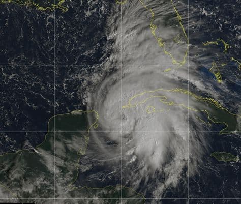
NEW JERSEY – New Jersey could be seeing heavy rainfall and flooding as Hurricane Michael makes its way up the east coast from the Gulf of Mexico this week.
With winds sustaining 75 mph as shown by the latest readings, Michael is labeled as a Category 1 hurricane located off the coast of western Cuba, according to the National Weather Service.
NWS charts show an anticipated 1-4 inches of rainfall in New Jersey by the end of the week, and high winds by Thursday. The Weather Prediction Center cites New Jersey’s main concern is rainfall. This could change depending on the course the storm takes over the following days.
It is not certain whether Michael’s trajectory will take the storm toward New Jersey; National Hurricane Center predicts that the storm could head back out to sea near the North Carolina and Virginia border.
Michael is expected to be weaker by the time it passes through New Jersey, should it make it that far.
As of October 8, a hurricane watch is in effect for parts of Cuba and a storm surge watch is in effect for parts of Florida, according to NWS. Michael is expected to make landfall near Panama City, Florida sometime on Wednesday.


