

TOMS RIVER – Despite numerous requests by local government officials and drivers in the region, sections of Route 9 in Toms River will not be widened.
A project to widen Route 9 was in the Concept Development phase, said Stephen Schapiro, deputy director of communications for the New Jersey Department of Transportation.
However, in order to do this, it would require the state to buy residential and commercial property close to the highway. It was estimated that it would cost about $555 million, he said.
There are other down sides involved, too, such as complex utility relocations and environmental impacts, he added. All of this put together made the project not feasible.
There is a project in place to widen parts of Route 9 in the northernmost portion of Toms River and Lakewood for left turns only. The concept would have added another lane to Route 9 for about a mile longer than what is currently intended.
County officials said that this decision needs to be reconsidered.
“We cannot believe that even after the completion of a study of this area of Route 9 clearly shows widening will greatly improve safety and traffic flow on this road – a major corridor in Ocean County – we have again been told by the state it’s not going to happen,” said Ocean County Freeholder Director Joseph H. Vicari. “We are calling on the NJDOT to fund the major improvement project as this is the help we need to bring this important corridor into the current century.
“Route 9 in Ocean County has not been widened or drastically improved since the days of the stagecoach,” Vicari said. “This particular area – between Lakewood and Toms River – is our fastest growing area and the decision to not do the major widening improvements creates nothing more than additional hazards brought on by unprecedented congestion all filtered into two lanes – one north, one south.”
The Freeholders, and Toms River Mayor Maurice Hill have said repeatedly that Ocean County residents pay tolls that are increasing and don’t get enough back for their investment.
Freeholder John P. Kelly, who is liaison to the Ocean County Engineering Department, said the smaller fixes to Route 9 that are planned just put a Band-Aid on the problem.
“Clearly abandoning the larger scope of this proposal does nothing but exacerbate further a critical transportation problem that is being experienced daily on this roadway,” he said.
Route 9 Improvements
This is not to say that nothing is being done on Route 9.
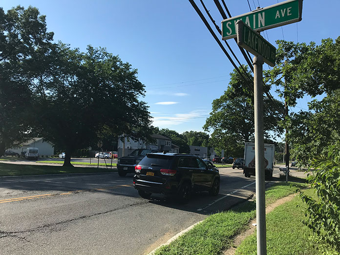
A different project is in the Final Design stage that will reconstruct a 6.9-mile section of Route 9 between Milepost 95.0 near Swain Avenue in Toms River and Milepost 101.9 near 2nd Street in Lakewood.
“The original project, which is moving forward, is expected to considerably reduce the travel times through the corridor and substantially reduce the number of crashes, addressing the main concerns at a reasonable cost,” Schapiro said. “This project will address and mitigate the most critical capacity, congestion and safety issues through this stretch of Route 9.”
In 2019, the project was estimated to cost $50 million.
The full cost won’t be known until the project goes out to bid and the contract is awarded, Schapiro said.
The construction is expected to take place from the spring of 2022 to the summer of 2024.
Generally speaking, the project will be adding a two traffic signals in Lakewood, widen eight intersections that have traffic lights, and add left turn lanes at seven intersections that don’t have traffic lights. There will also be milling and paving work done. Wider sidewalks compliant with the Americans with Disabilities Act would also be installed. Access points to and from properties on Route 9 would be improved to be made safer.
There are a lot of intersections where the traffic pattern won’t change, such as on Cox Cro Road. However, throughout Route 9 there would be improvements in terms of such things as paving, drainage, curbs and sidewalks. There will also be two miles of sidewalks added.
The plans are still in the final design stage, and as it stands now, these are some of the changes proposed:
Whitty Road
Route 9 northbound would be widened for the existing designated right turn lane onto Whitty Road.
Southbound Route 9 would be widened for the existing left turn lane onto Whitty Road.
Whitty Road’s westbound lane would be split into left and right turn lanes.
Church Road
On northbound Route 9, there would be a right turn only lane added for drivers going east on Church Road.
On southbound Route 9, there would be a left turn only lane added for drivers going east on Church Road.
On Church Road, drivers heading west would have two lanes: a left turn only lane and a right turn only lane.
Locust/Honey Locust
Locust Street (which links Route 70 to Route 9) would be widened near the intersection with Route 9. One lane would go through and left. The other would go right (north on 9).
Honey Locust street, which meets Route 9 from the other direction, would be widened as well. A right turn only lane for people going south on 9 would be added.
Chestnut Street
Westbound on Chestnut would become three lanes: left, straight, and right.
Eastbound on Chestnut would become three lanes: left, straight, and right.
Chateau/Broadway
There would be significant changes near this area, where the big “Center of Town” shopping center is (formerly Chateau Grand and Winkelmann’s Restaurant). Chateau Drive would be realigned with a little curve to the south, so that it can meet Broadway at a new traffic signal there.
Chateau would have a left turn only lane at the intersection. So would Broadway.
Route 9 would be widened to have left turn only lanes in both directions.
Oak Street
Oak Street would get a new traffic signal.
Northbound Route 9 would be widened into three lanes: left, straight, and right.
Southbound Route 9 would be widened to add a left turn only lane.
Oak Street westbound would have two lanes: right turn only, and left/through.
Just north of that, there is an intersection that is called River Avenue (even though Route 9 is also called River Avenue). That intersection would have left and right turn lanes coming out of the development.
Again, just north of that is Hadassah Lane. There would be a left turn only lane from Route 9 north into that development.
Spruce Street
Left turn lanes would be added to Route 9 in both directions, so that drivers can make lefts onto Spruce from the north or south.
Spruce is just south of the hospital.
Pine Street/James Street
Pine Street would be realigned to meet James Street at a safer angle.
James Street would get a designated left turn lane onto Route 9 north.
Hurley Avenue/Central Avenue
This is the intersection by the lakes.
The southbound left turn lane would be eliminated. Instead, there would be a second northbound lane. The two remaining southbound lanes would be one through lane and one right turn only onto Central.
Where Central and South Lake Drive meet, there would also be changes. Driving west on Central, drivers can make a right onto South Lake. If you are driving on South Lake, you will only be able to make a right onto Central. You won’t be able to merge onto Central and then head to 9.
Similarly, people on Caranetta Drive will only be able to make right turns onto Central. They won’t be able to go left on Central.
Route 88
On Route 9, the southbound left turning lane leading to Route 88 would be extended by 400 feet.
1st Street
A concrete island would be installed on Route 9 at the intersection with 1st Street that would prevent anyone from making left turns onto Route 9 from either direction.


