

By Chris Lundy and Alyssa Riccardi
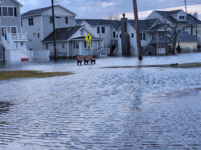
JERSEY SHORE – A coastal storm that made its way across the state on January 9 had left thousands of people without power and brought severe flooding to local streets throughout Ocean and Monmouth Counties. It underscored the importance of resiliency in the face of flooding.
The National Weather Service issued coastal flood warnings and wind advisories. It noted peak records of flood heights, stating that certain areas of Ocean County reached nearly five feet of water levels.
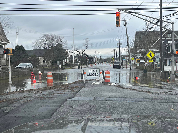
In Brick, flooding was reported on the Route 35 Spur south of Sixth Avenue according to the State Department of Transportation website 511nj.org. All lanes were closed and detoured. There was also flooding south of Normandy Beach. Parts of Brick’s residential communities such as Cherry Quay and Shore Acres also had roads filled with water.
Many cars in Bay Head were partially underwater. Streets were closed off in coastal communities near the Barnegat Bay, including Seaside Heights and Seaside Park, the Ocean County Sherrif’s Office reported.
Many roads in Toms River were affected by the storm, with NJDOT reporting several streets flooded. A major intersection at Fischer Boulevard and Route 37 was reported flooded, with the right shoulder closed and the ramp closed.
Residents shared online how multiple roads in Silverton were flooded the following afternoon due to the rain as well as the high tide from the lagoons and bay.
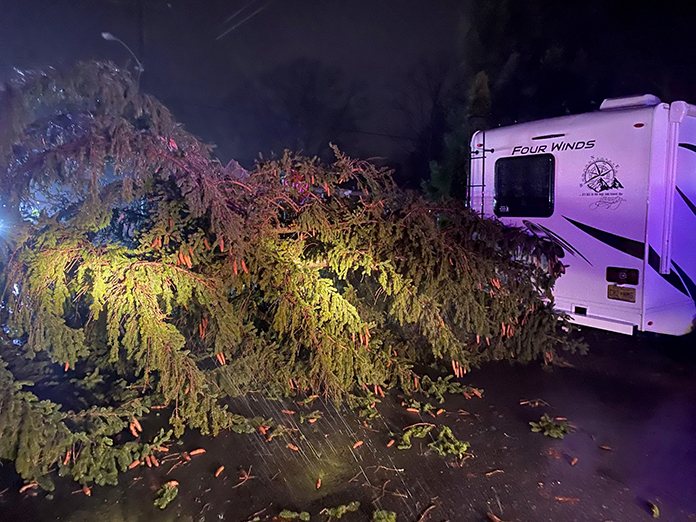
Other areas in Ocean County like Berkeley Township were flooded with debris from the marsh and had downed trees and poles. Mayor John Bacchione stated that the Township is looking for way to preserve their quality of life moving forward.
“I have scheduled a meeting with our Township Planner, OEM Coordinator, Police Chief, the township’s grant writer and others to look for ways to improve our drainage systems to either elevate or mitigate the impacts of these storms on our roads and infrastructure,” Bacchione said.
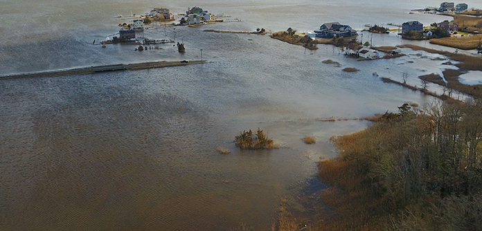
There are several low-lying areas of Berkeley. Pelican Island (which is right over the Route 37 bridge to Seaside) and South Seaside Park (just north of Island Beach State Park) are both parts of Berkeley and saw flooding.
The Bayville Volunteer Fire Co. and Berkeley Parks Department were out taking care of downed trees. There were also multiple poles down in Holiday City, the mayor said.
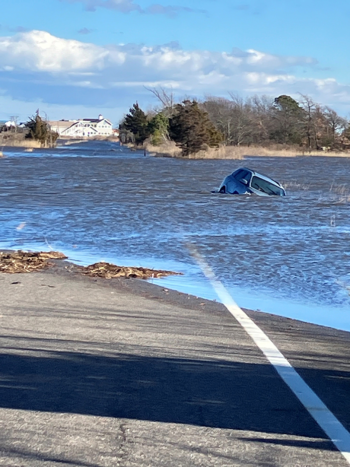
He put out a warning telling residents not to drive through any bodies of water and not to move, drive around, or alter barricades or flood warning signs.
Bacchione said he hopes to secure state or federal funding for mitigation projects. “These coastal storms are becoming more frequent, and we need to look for long term solutions.”
Bayview Avenue in particular was covered in water. This is not new. If you do a search of Bayview Avenue, one of the photos that comes up on Google is of the road being flooded in April of 2018.
Councilman James Byrnes has been trying to get federal money to deal with this recurring problem. It used to be that every three years or so, Bayview would flood. Now, it’s a lot more frequent. This is an evacuation route and the main way for emergency vehicles to get to residents in those neighborhoods. If someone is having a medical episode, this could be a life or death situation.
He said instead of the county milling this road, they should just build it up the next time it has to be paved.
Ocean County Engineer John Ernst shared a list of past, present and future road projects to address flooding. Past ones finished over the last few years include areas such as Long Beach Boulevard on LBI, Bay Avenue and New Hampshire Avenue in Toms River.
Current projects include Flint Road in South Toms River, Baltimore Avenue near Yale Avenue in Point Beach, Arnold Boulevard at Sunset Boulevard in Long Beach, Dickman Avenue in Lavallette, Barnegat Avenue from 20th to 22nd Streets in Berkeley, Central Avenue and 28th Steet in Ship Bottom, and Bridge Avenue from W. Lake Avenue to Club Drive in Bay Head.
Future design projects include raising Radio Road from Louisiana Drive to the southern terminus in Little Egg, I Street from Route 35 to Bayview Avenue in Seaside Park, and Bayshore Drive from Biscayne Road toward the bridge in Barnegat.
Two projects will have the roadway regraded, with drainage improvements including a tide check valve to mitigate flooding. These are at Long Beach Boulevard from 52nd Street to 53rd Street in Long Beach Township and Broadway from 5th Street to 7th Street on Barnegat Light.
Two spots in Surf City will have drainage improvements including a tide check valve: Central Avenue near N. 1st Street and Barnegat Avenue from 5th to 6th streets.
Over in Monmouth County, NJDOT reported flooding in Howell Township on Route 33 eastbound, east of Fairfield Road.
Save Barnegat Bay posted wind speeds and rain amounts from nearby weather stations:
- Bathhouse #1, Island Beach State Park: 72 mph, 2.83″
- Stafford Township Municipal Complex: 49 mph, 2.32″
- Long Beach Township Field Station, Holgate: 48 mph, 2.10″
- Beachwood Yacht Club: 46 mph, 3.14″
- Long Beach Island Foundation, Loveladies: 44 mph, 2.00″
- MATES, Manahawkin: 44 mph, 2.58″
- Save Barnegat Bay EcoCenter, Toms River: 39 mph, 2.55″
- Ocean Gate Yacht Club: 38 mph, 2.85″


