

BRICK – May 7 marks the 14th anniversary of the completion of a 1.6-mile trail around the rim of Brick Reservoir, which was the final piece of the 10-year-long project that began in April of 1992.
That was when the Brick Township Municipal Utilities Authority (BTMUA) identified the abandoned sand and gravel mining pit as a potential sight for the development of a stored water reservoir.
Located on Sally Ike and Herbertsville Road, the 120-acre site has the highest elevation in the township at 105 feet above sea level, allowing the stored water to flow by gravity to the BTMUA water treatment plant.
“It was a very sophisticated project which took a lot of NJ Department of Environmental (NJDEP) approvals,” said BTMUA Deputy Executive Director Stephen Specht in a recent phone interview.
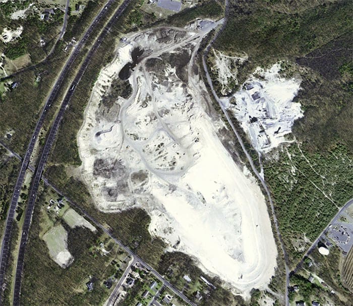
Specht provided a timeline for the project, that started as a big hole in the ground from years of mining operations, which would later save on reservoir grading and excavation costs.
After identifying the site, the BTMUA commissioned a Reservoir Screening Study in June of 1995 which determined that the site was feasible for a reservoir project, provided that a liner was used.
In April 1996, the BTMUA purchased the land (located in both Brick and Wall Townships) for $810,000.
According to a newspaper at the time (The Brick Bulletin) the acreage was appraised for $12 million, and 500 homes were planned for the site. The land was owned by Manasquan Bank, but with bankruptcy proceedings underway for several years and tax liens against the property, the BTMUA negotiated the lower price.
In July 1997, a preliminary design for the reservoir was prepared by Montgomery Watson Harza, Inc., which included a raw water intake on the Metedeconk River and a transmission main from the intake structure to the reservoir.
The 42-inch diameter transmission main is 4.7 miles long, and the pipeline carries the water from the reservoir to the BTMUA headquarters on Route 88.
Specht said there is just one intake west of Forge Pond and it can pump up to 32 million gallons of fresh water a day into the reservoir.
The pumped water is from the Metedeconk River watershed, which starts at Turkey Swamp, branches into Forge Pond and flows into Barnegat Bay, where the water goes from fresh to brackish to salt.
Between the years of 1999 and 2001, contracts were awarded to several entities to remove miscellaneous debris at the site; to demolish existing buildings; to remove and dispose of 33,500 tons of steel slag that had been stockpiled there; and to remove and dispose of 4,500 tons of Kaofin (a by-product of Marcal paper products) found in four locations at the site.
Starting in January of 2001, the BTMUA had to excavate 1,000,000 cubic yards of overburden material at the future reservoir before they could apply for various NJDEP permits associated with its construction.
With permits in place, in May 2002 a $6.7 million contract was awarded to Ace Manzo, Inc. and D. Manzo & Son, Inc. for the underground pipeline.
In the same month, a $19.6 million contract was awarded to Scafar Contracting for the raw water reservoir and the treatment plant modifications. BTMUA received a low interest loan for the project through a state program.
A 40 millimeter-thick vinyl liner (about the thickness of a credit card) was installed and covered with 18 inches of packed soil to contain the water pumped from the Metedeconk River. The reservoir itself is 90 feet deep.
The liner was the first of its kind to be constructed in New Jersey, and at the time was only the second to exist in the country.
As the reservoir was constructed and completed, more NJDEP permits were granted in the fall of 2003, and in April 2004, the month long process of filling the 1 billion-gallon reservoir began.
When the basin is filled to capacity, it covers about 90 acres of the property.
By September 2004, the $19.4 million Brick Reservoir was substantially completed and dedicated for operational use only.
Brick Reservoir provides water for Brick Township, the Ramtown section of Howell Township, Point Pleasant Beach, and supplements the water supply for Point Pleasant Borough and Lakewood.
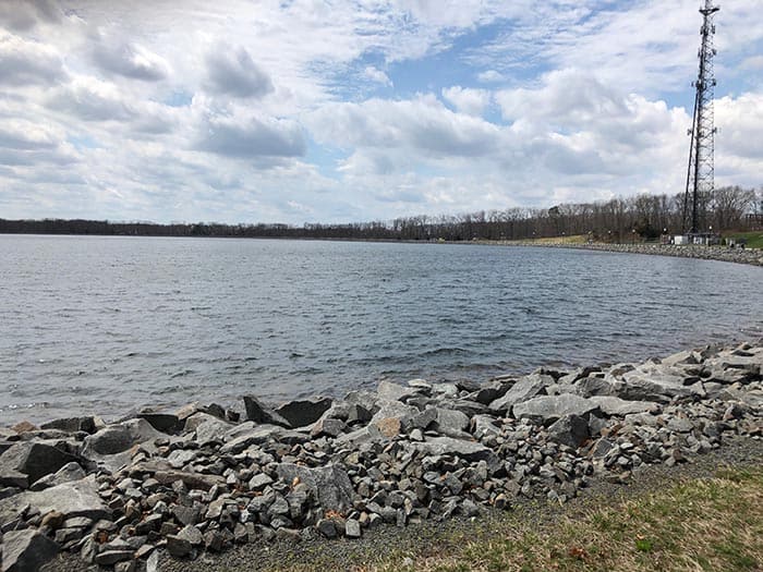
A 270-foot tall communications tower is also located on the property, and in December of 1997 the BTMUA signed a 30-year lease agreement with Atlantic Coast Communications totaling $925,000, which largely paid for the cost of the 120-acre site.
The tower was completed in April 2001 and they began their rental payments to the Authority.


