

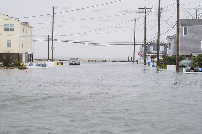
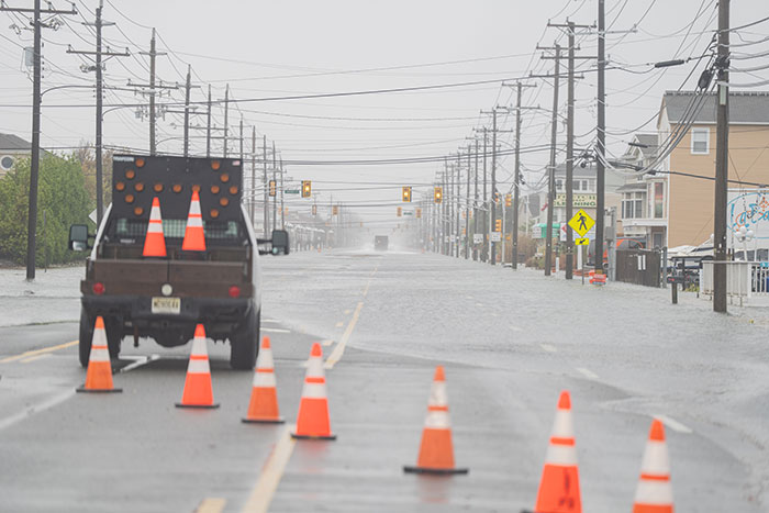
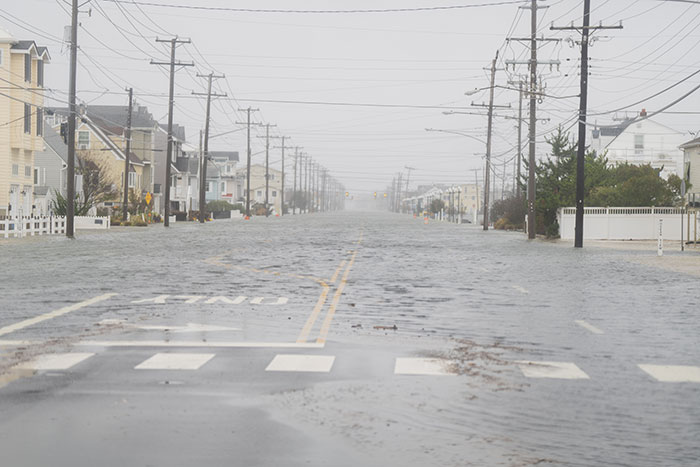
LONG BEACH ISLAND – When the October nor’easter churned its way up the East Coast, the winds and tides seemed relentless. For locals, it looked like yet another autumn storm. For scientists, it was a near-perfect illustration of what’s happening beneath the surface, both literally and climatologically.
According to Dr. David A. Robinson, New Jersey’s State Climatologist at Rutgers University, fall coastal flooding isn’t unusual for the Jersey Shore. Some years bring more of it than others, but these seasonal events have always been part of the barrier island’s rhythm. What made the mid-October storm stand out wasn’t its strength, but its persistence.
The nor’easter, Robinson explained, was a slow-moving low-pressure system that stalled just southeast of New Jersey. Over several days, steady easterly winds pushed ocean water toward the coast and into the bays. Because the storm lingered through multiple tidal cycles, new water arrived before the previous high tide could recede. The back bays, unable to drain fast enough, bore the brunt of the flooding, a pattern increasingly common across the central Jersey Shore.
The Back Bay Problem
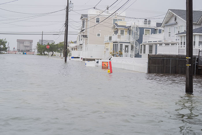
For homeowners on LBI, flooding from the bay has become more than a storm-season worry. Robinson said the science behind it is clear: “Sea level continues to rise along the Jersey coast and is expected to accelerate throughout the remainder of the 21st century, and beyond.”
Because bayfront properties tend to sit lower than the dunes and back dune areas on the ocean side, he said, “the impacts in the bay areas will likely be more notable on a day-to-day basis than on the ocean side.” While ocean overwash remains a risk during strong storms, it’s the quieter, more frequent tidal flooding that’s likely to keep creeping inland.
There’s no evidence, Robinson emphasized, that storms are becoming more frequent.
“However, with ongoing sea level rise, the frequency of nuisance flooding days is virtually certain to increase – whether caused by storms or just the phase of the moon,” he said. “While storm frequency may not change, there is concern that storm strength might be greater due to warmer waters off our coast helping to fuel the storms.”
Tracking The Rise
At Rutgers University, Dr. Marjorie B. Kaplan, Senior Associate Director of the Rutgers Climate and Energy Institute and Co-Director of the New Jersey Climate Change Resource Center, has been closely monitoring sea-level trends and their impacts on New Jersey’s coastline.
Kaplan noted that Rutgers’ data shows an unmistakable pattern with minor flooding days increasing from less than one per year in the 1950s to more than 13 annually in the past decade.
Under federal projections for moderate sea-level rise, there’s an estimate of between .5 and 1.5 meters by the year 2100. The frequency of minor flooding could triple by 2030 and multiply tenfold by mid-century. That means communities like Long Beach Island can expect tidal water in the streets on as many as 95 to 135 days each year by 2050. Experiencing nuisance flooding one out of every three to four days each year would be more than just a minor inconvenience.
Kaplan added that Rutgers is finalizing a new report from the New Jersey Science and Technical Advisory Panel on Sea-Level Rise and Coastal Storms, which will update the state’s projections and compare them to international climate assessments. Both state and federal analyses show the same pattern: New Jersey’s sea level is rising faster than the global average, due to a combination of global warming and regional land subsidence.
Reading The Climate Signals
Climate cycles also play a role in shaping the shoreline’s future. “Modes like the North Atlantic Oscillation (NAO) influence storm tracks and speed of movement,” Robinson said, causing more storms for the eastern U.S. “During the cold season, an El Niño event tends to lead to fewer coastal storms, while a La Niña or what’s called an ENSO-neutral period tend to increase the chance of a nor’easter, potentially with associated flooding.”
He added that these modes are “not a major summer factor, except that Atlantic tropical activity tends to be greater during a La Niña period.” Combined with warming ocean temperatures, these cycles can influence both the severity and the persistence of storm systems, key factors for a barrier island like LBI.
Holding The Line With Sand
The New Jersey Department of Environmental Protection (NJDEP) oversees much of the island’s engineered defense system, which consists of sand dunes and beach berms initially constructed by the U.S. Army Corps of Engineers (USACE).
The Army Corps “completed the initial construction in stages and turned the project over to NJDEP in 2016 for continuing operations and maintenance,” the department explained. “The U.S. Army Corps of Engineers conducts periodic nourishment to maintain the engineered dune and berm system. In between nourishments, the NJDEP and municipalities are responsible for operation and maintenance.”
That work includes “maintaining dune crossovers and walkways, repairing and maintaining sand fencing, and other tasks to maintain safe access to the beach – all in compliance with environmental regulations.”
The dune and beach fill project “is monitored annually by local municipalities, NJDEP, and the USACE,” with a “seven-year cycle for periodic nourishment.” The department also partners with Stockton University, which provides biannual surveys of New Jersey’s coast – a program that’s been running for nearly four decades.
“These projects have proven to be effective at reducing damages to infrastructure from coastal storms,” DEP officials said, citing protection for “homes, businesses, roads, and utility lines.” But future success depends on continued funding.
DEP officials acknowledged that federal budget proposals have included deep cuts to beach replenishment programs, which could delay or limit the work.
Adapting To A Higher Baseline
As for local action, Robinson said infrastructure improvements can help in the short term but are no silver bullet. “From all I’ve heard and seen, pumps are not particularly useful,” he said. “The area sits at or close to sea level, so where can you put any pumped water to remove it from the region?”
Instead, experts recommend a mix of engineered and natural solutions, from elevating homes and roads to restoring wetlands that act as natural sponges.
Robinson offered a practical outlook for the near future. “I would suggest looking to flooding events over the past two decades as an indication of where conditions may lie in the next five to fifteen years,” he said. “Nothing of a dramatic upswing in severe flooding intensity or frequency is expected. What should occur, however, are increasing instances of the sunny-day flooding mentioned above.”
Residents will continue to rebuild dunes, monitor tides, and adapt their homes. But as both Robinson and Kaplan make clear, the tides themselves are the truest measure of time on LBI – and they’re keeping their own steady rhythm, and are higher every year.


