
OCEAN COUNTY – It was a day to roll down windows and enjoy the 60-degree temperatures, but salt trucks were amid the traffic this afternoon February 8 as towns geared up for overnight snow predicted to fall throughout February 9.
The National Weather Service Mount Holly issued a 5 a.m. update to its forecast, upgrading a possible 4 inches plus to a winter storm warning.
The heaviest snow is forecast for 3 a.m. to 10 a.m. February 9, with two inches per hour predicted to fall across the Jersey Shore to Delmarva Peninsula. NWS warned of heavy snow, poor visibility and dropping temperatures making a dangerous morning commute. The next weather update from NWS-Mount Holly is expected at 5 p.m. February 8.
The NWS forecast:
Snow will quickly develop from west to east after midnight February 9. However, it will start as rain from about the I-95 corridor eastward, with a transition to snow from northwest to southeast early Thursday morning.
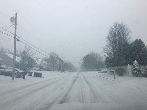
The changeover to snow will likely occur quickly in the I-95 corridor by daybreak. It will take longer though to change over to snow on February 9 near the southern New Jersey coast and Delmarva. The earlier Winter Storm Watches have been upgraded to Winter Storm Warnings.
Winter Weather Advisories have been issued for far southeastern NJ, central DE and portions of the Eastern MD Shore. See next slide for a graphical depiction.
Hazards/Impacts: Heavy snow, poor visibilities and dropping temperatures will make travel dangerous. Snow will fall at a rate of up to 2 inches per hour in the warned areas from about 3 to 10 a.m. February 9 from west to east, with even some thunder possible.
High impact event for travel especially for the Thursday morning commute.
Temperatures are expected to quickly drop to freezing or lower late February 8 and early February 9 morning from west to east for much of the region. This along with heavier snow and initially milder road surfaces may result in snow quickly becoming packed to the road surface.
Temperatures will drop into the teens February 8 night hours with any slushy or untreated wet surfaces freezing up. The snow should be wet in consistency and therefore will tend to stick to trees and power lines, possibly resulting in some power outages. North to northwest winds will increase into February 9 with gusts in the 30-35 mph range.

