
")
BRICK – Few things are worse for boaters than hearing the sickening thump and scrape after unexpectedly hitting bottom, and many boaters have reported damage to their boats in areas when shoaling has occurred.
That won’t be a problem for much longer in township channels, because for the first time in decades, the NJ Department of Maritime Resources is dredging the navigable channels, which is the transportation network for boats.
The areas that will be dredged include portions of the northern and southern branches of the Beaver Dam Creek; northern and southern branches of Kettle Creek; a section of the channel near the former Hinckley’s Yacht Services at the base of the Mantoloking Bridge; and portions of Green Cove Channel on the Metedeconk River.
Channels should be five feet deep at low tide, and they can over-dredge, said township engineer Elissa Commins, who calculated that the dredge spoils (the material that will be excavated from township channels), based on yardage, would fill the area of a football stadium – including the end zones – to 100 feet high.
Commins attended a pre-construction meeting for the project in September 2017, and said that the dredged areas would only include sections of the channels that’s needed for navigation.
The dredge spoils will be placed in two of many “dredge holes” that were dug up and down the along the barrier island when the island was widened and when the original construction of Route 35.
One of the dredge holes is located off Bayside Park, opposite Brick Beach 3, which Commins said is about 26 feet deep and has the capacity to hold 175,000 cubic yards of material.
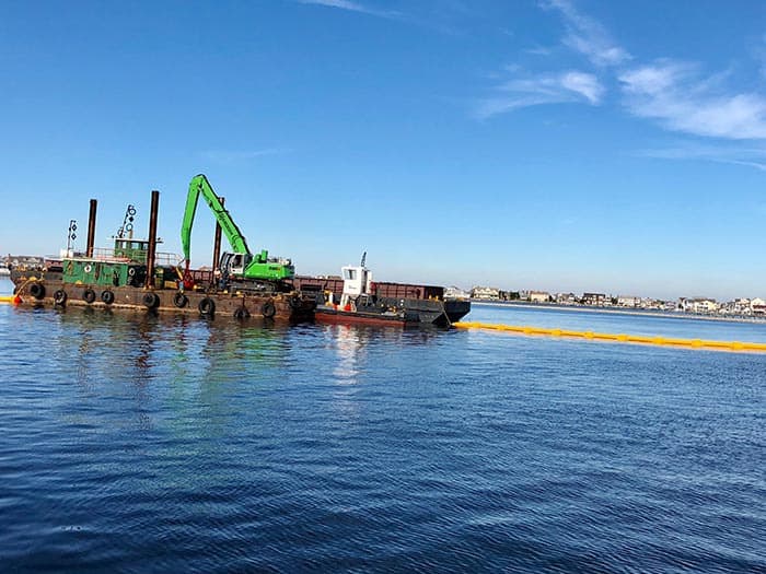
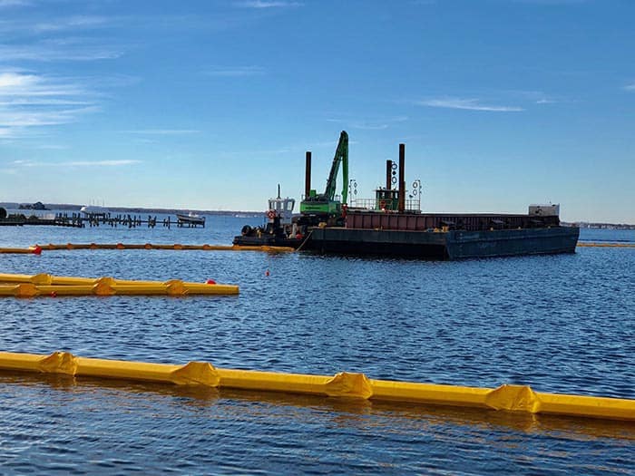
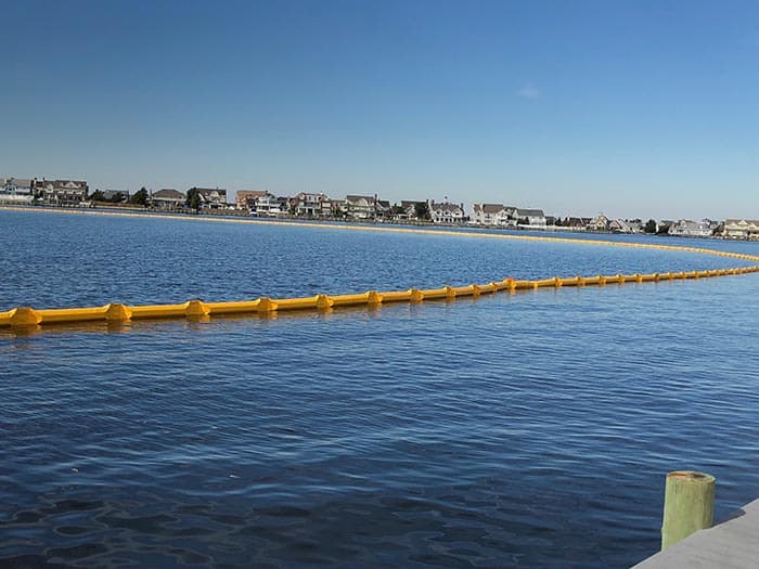
A large barge is currently anchored off the park, and a turbidity barrier boom is in place that will keep sediment and silt in place while allowing water to pass through, Commins explained.
The second dredge hole that will be utilized for the project is off Chadwick, which has a capacity to hold 260,000 cubic yards of material.
The DEP has all of their permits in place for the dredging and dredge spoils placement, and Commins said that the dredge holes are typically void of aquatic life since they are isolated deep holes of colder water and in great contrast to the surrounding ecosystem.
The project would be mechanically dredged with no hydraulic dredging or pipeline involved, Commins explained.
Dredging would continue until December 31 and would restart at some point to be determined next summer, she said.
The NJ Department of Transportation’s Office of Maritime Resources provides interagency support, program planning and policy recommendations on maritime issues. They advance public education on all maritime and marine issues and serves as the primary advisory body and lead agency for support of New Jersey’s $50 billion maritime industry.
According to NJDOT, some of the channels in Monmouth and Ocean Counties experienced shoaling as a result of Superstorm Sandy, limiting boating options, emergency response and commercial traffic in the areas.
Some $20.2 million has been earmarked for dredging projects as part of a comprehensive State Channel Dredging and Emergency Response Program announced after Sandy in March 2014.
No local taxes would be used for the dredging project, Commins said.


