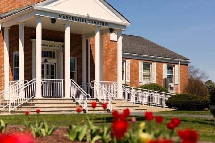

MANCHESTER – Residents will be offering up their thoughts on the township’s master plan through a new community visioning survey at the request of officials.
Locals have not been shy at Township Council meetings about their dislike of over development, traffic, warehouses and data centers. They will have the opportunity to share their voices through the Community Visioning survey which focuses on what they want to see for the future of the town from a land use planning perspective.
According to the township website, “the community is seeking State Plan Endorsement, a voluntary review process designed to ensure the coordination of state, county and municipal planning efforts. Part of the planning process is for a community to envision the future that it wants, and how it plans to achieve it. This survey is an opportunity to gather feedback and input from you about your vision for the future of Manchester.”
According to the state Office of Planning Advocacy (OPA), part of New Jersey’s Department of State, that office “coordinates statewide planning to protect the environment and guide future growth into compact, mixed-use development and redevelopment.”
The endorsement process expands on municipal land use law and incorporates current state policies, regulations and priorities. When a municipality receives master plan endorsement it allows that community to be “eligible for a host of benefits provided by state agencies,” according to the state. That includes coordinated capital investment and planning implementation mechanisms.
During the latest Township council meeting Council President Michele Zolezi urged all residents “to tell your neighbors and friends to participate in the survey.”
Business Administrator Carl Block spoke about the survey and discussed the township’s digital map that shows the various zones of property that exist within the community and areas where development is taking place.
“If anyone has a comment please respond to the survey. The comments will be collected and we will be submitting them to the OPA office for our center designation application which will be a prelude for some changes to our master plan. Some people are commenting on Facebook. We need them to go to the survey on the website. They will be collected by our planner and submitted,” Block said.
He said the next meeting of the OPA is expected to be November 2. “We are still targeting December/January to have that portion of our planning up next with the traffic survey that has the traffic counts in with all the data. The consultants are preparing to generate a report of existing conditions. Next we will look at what intersections and road improvements need special attention.” That portion would be a follow-up report expected in January.
“We’ve been talking about how to get more people to view what is out there in the township. About a year and a half ago we put the GPS map up. This was a map we were using internally and gives you some layers and some specific sites that you can go in and look at including the owner’s name of a specific lot,” he added.
“We have another digital map made that have colored areas that shows things like where the Pinelands jurisdictions are (an area with specific environmental protections). There is a particular color shade for the regional growth area and there are others for conservation and preservation areas,” he said.
“This is still a work in progress. We are still trying to improve it and add things. There is an environmental layer that will show you wetlands, buffers, flood plain areas. The public can readily see what is there and there will be some improvements coming to allow for the public to know if the Planning Board has approved things. It will give you a layout of the actual approval so if there was a 12 lot subdivision on lot 54 it will show you the layout of what was approved and you can overlay that on top of the imagery to see what was there and what was approved on top of it,” Block explained.
When construction is proposed, they are working on adding that information as well, he said. You could click on the land and it would show what the proposal is, he said. “There will be general information and if you want details you could go to the Planning Board office or to a Planning Board meeting as the case may be.”
There is currently 51.77% of the town protected as open space, Block said, “and of course we want more.” This is further broken down by land protected by township, county, or state funds.
The Master Plan survey plan can be filled out on line by visiting survey123.arcgis.com/share/cc20313cf7564eba86152bfec3dbc065.